Our Beautiful World as Seen Through the Lens of Mike Hollingshead [30 Pics]
Aug 16 2012
We seriously had a difficult time narrowing down this post to thirty photos - phenomenal photography.
Make sure to check out Mike's blog + click the photos for higher resolution versions.
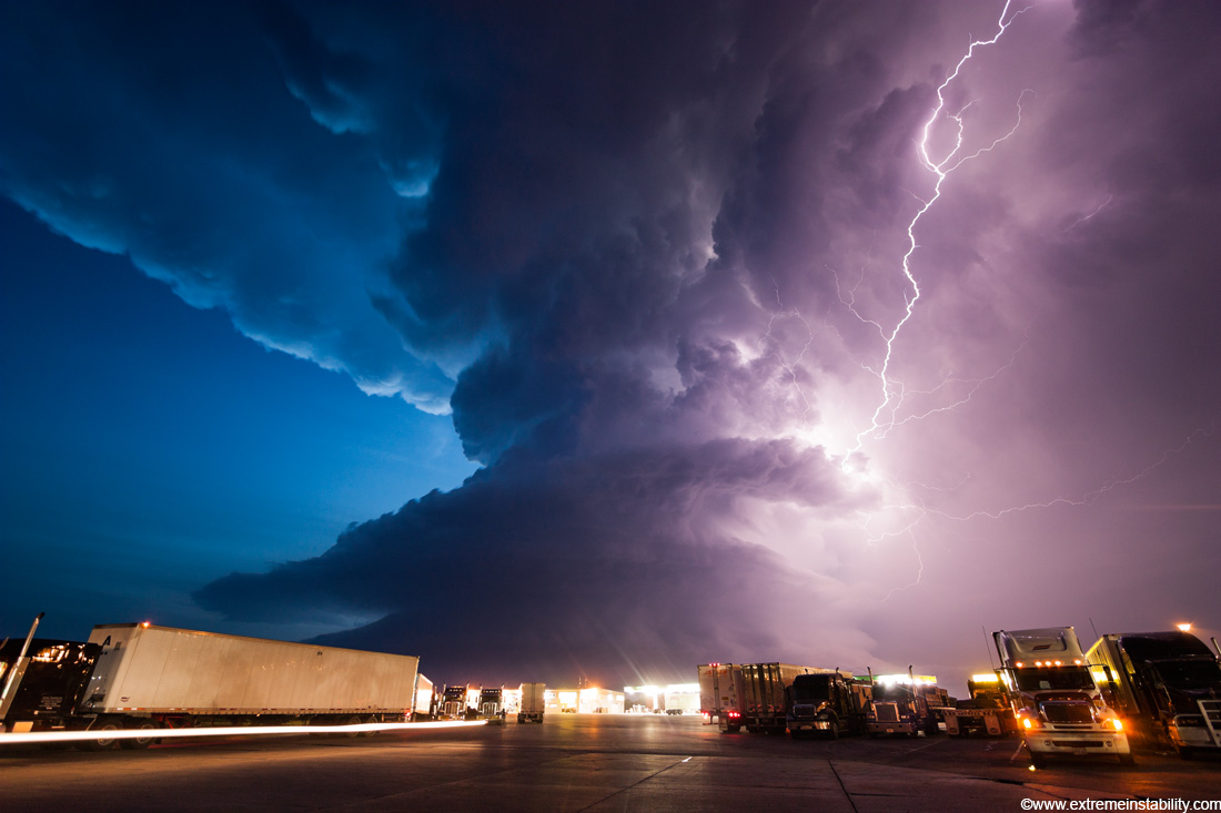
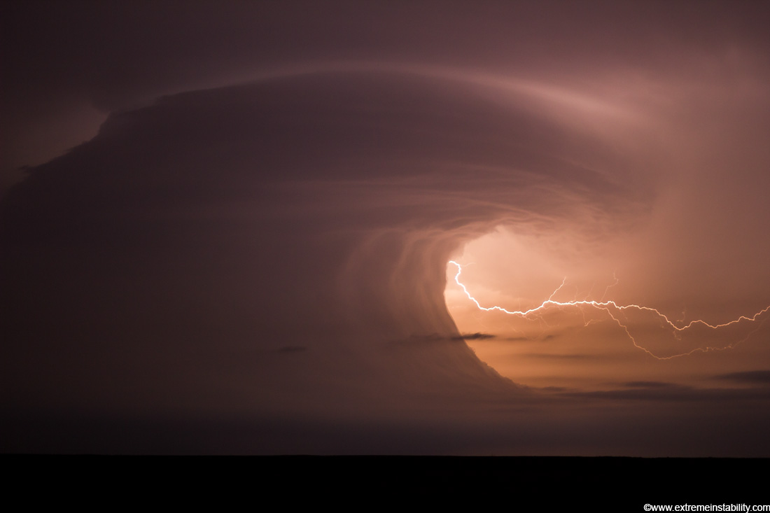
[Cover Photo] Amazing supercell storm during twilight nears a York Nebraska truck stop on I80 as it spits out lightning, June 17, 2009. Only a half hour or so earlier this storm was producing a long-lived large tornado near Aurora Nebraska.
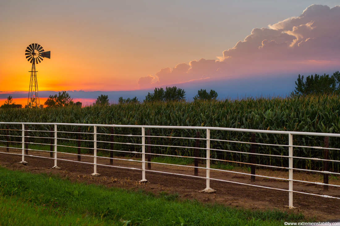
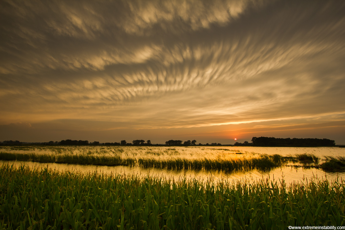
Sun with storm nearby sets over a cornfield in eastern Nebraska.
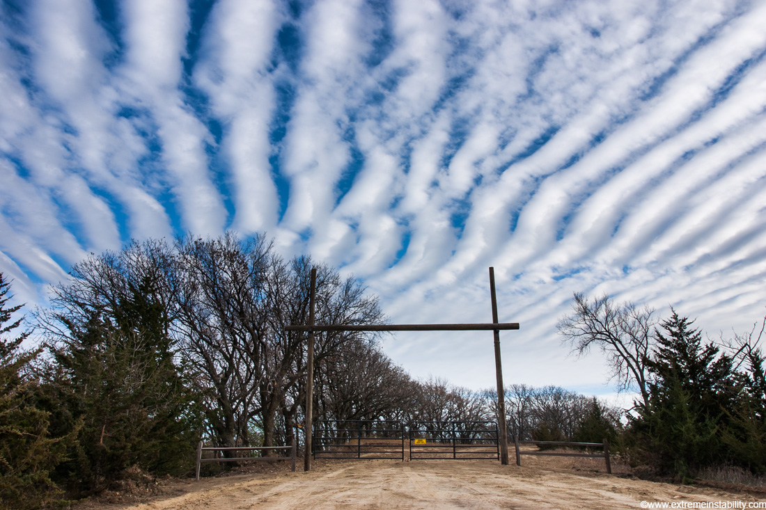
Clouds streets form over eastern Nebraska.
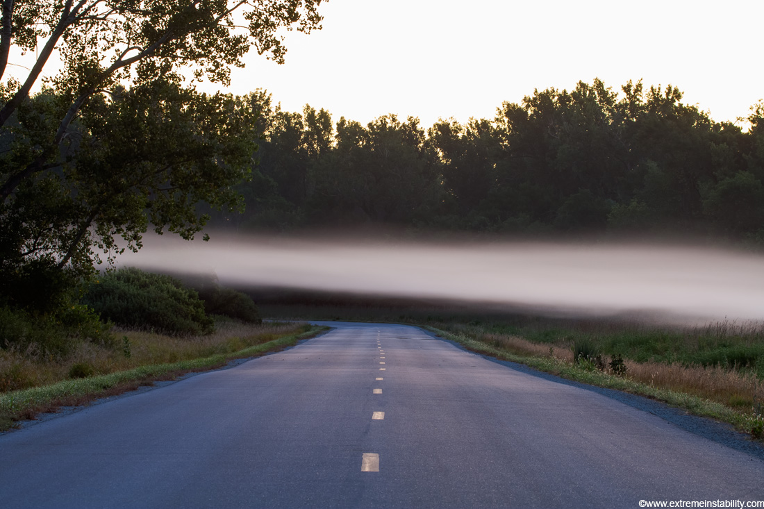
Fog moves from one cornfield to another in western Iowa, August 29, 2008.

Bald eagles feed on snow goose at the Squaw Creek National Wildlife Refuge in northwest Missouri near Mound City. Rather than kill another snow goose, the eagles prefered to fight one another over carrion already on the ice. The colder the weather, the more agressive the eagles seemed to be.

Mammatus off severe storms in northeast South Dakota, May 22, 2010.

Fog settles in the valleys of the Loess Hills of western Iowa.
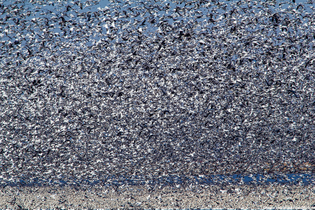
Snow Geese at Squaw Creek National Wildlife Refuge during spring 2012 spring migration with over 1 million birds.

Sun shines on morning frost and snow at Desoto Bend National Wildlife Refuge in western Iowa.
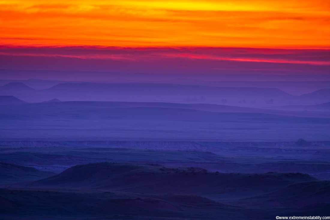
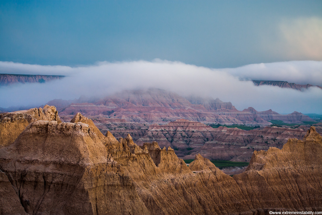
Early morning fog settles in the Badlands in southwest South Dakota, June 18, 2008.
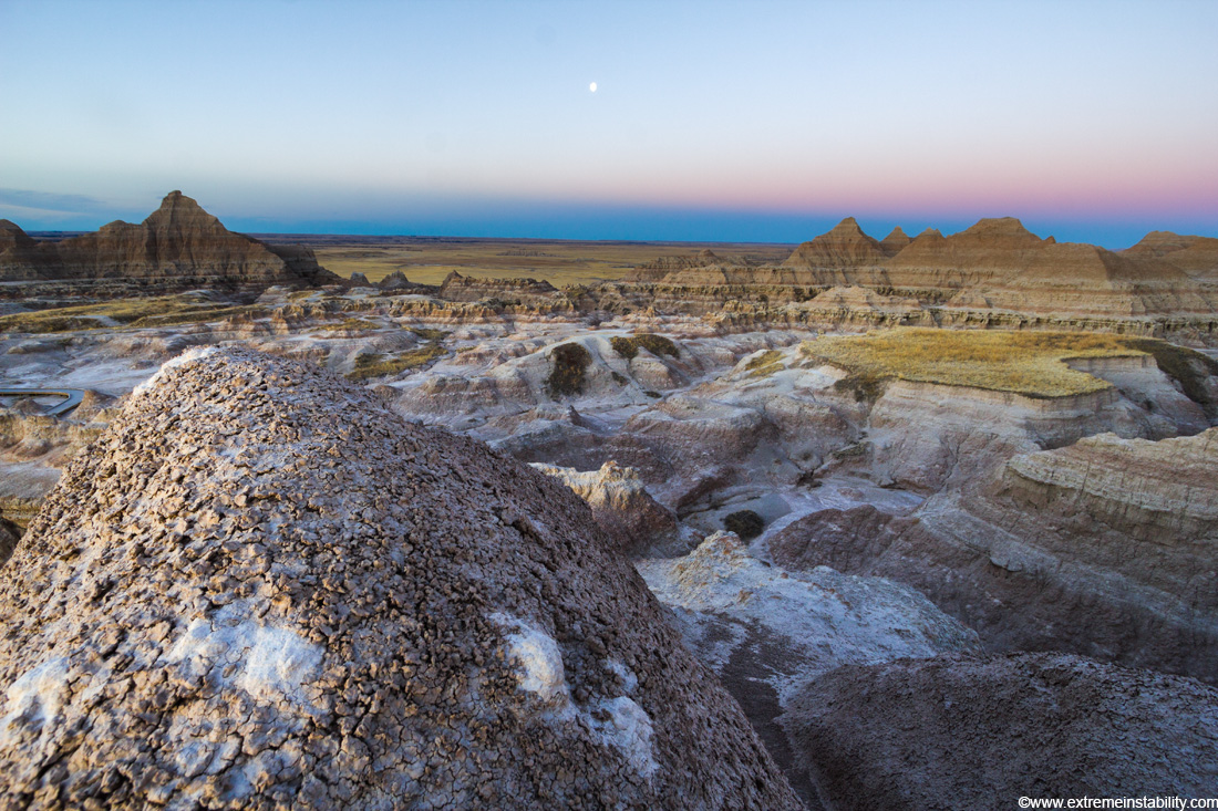
Moon sets over the Badlands of South Dakota toward sunrise.
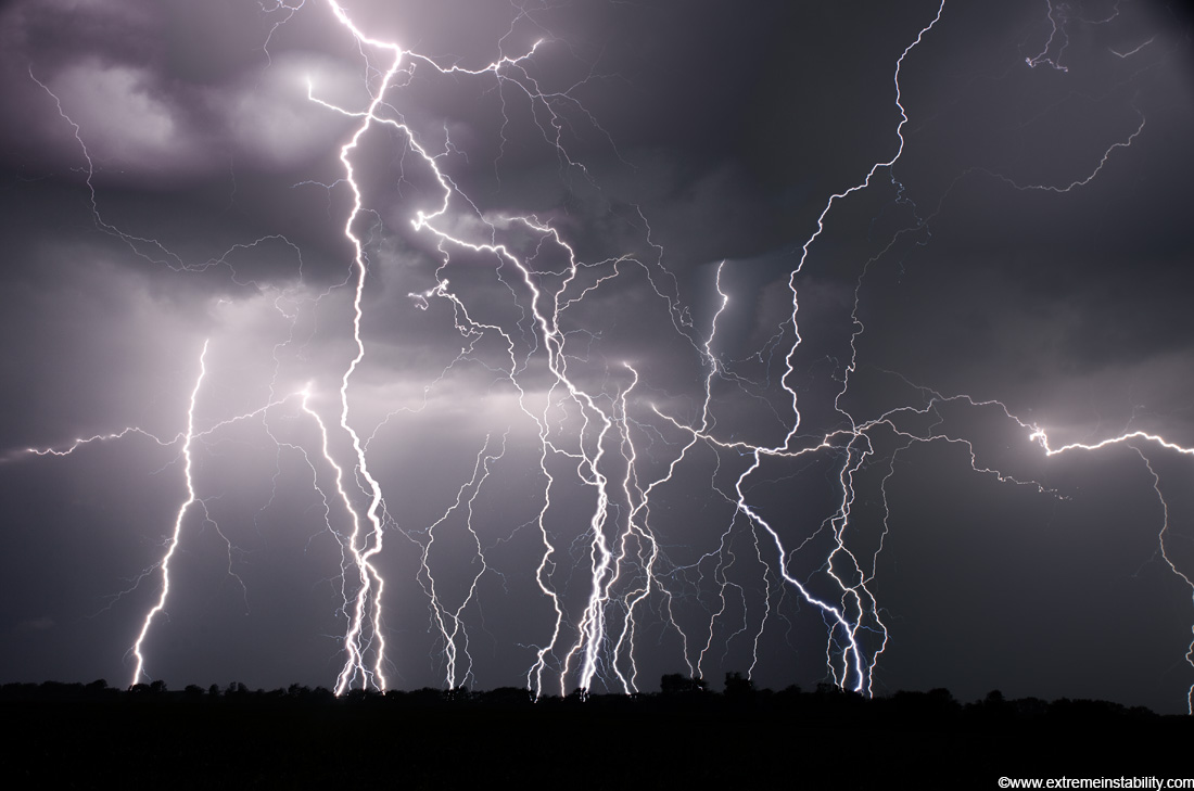
Lightning strikes western Iowa June 20, 2010. Several long exposure photos stacked.
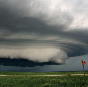
Supercell storm with small tornado moves across the badlands area of southwest South Dakota near Kadoka, June 7, 2005.

One of many tornadoes to form under a long-lived supercell on the Kansas Nebraska border, May 24, 2004. This supercell produced upwards of 15 tornadoes in just a few hours. It frequently had more than one tornado on the ground at the same time.
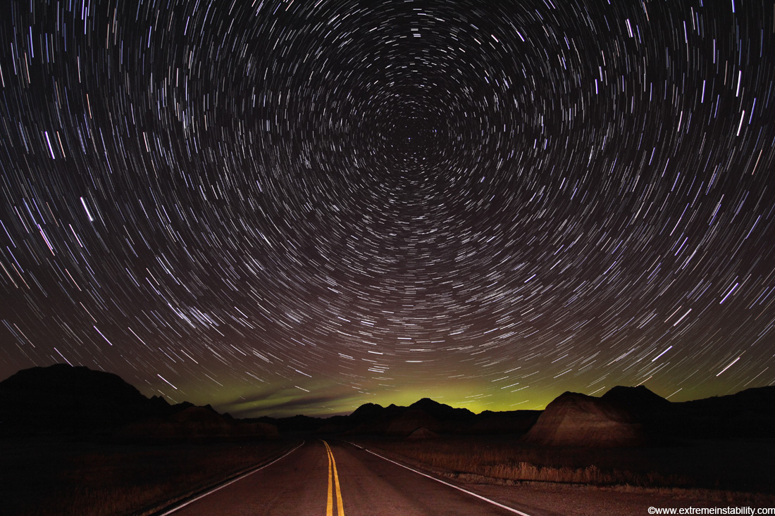
Auroras shine over the Badlands of South Dakota as the stars trail.
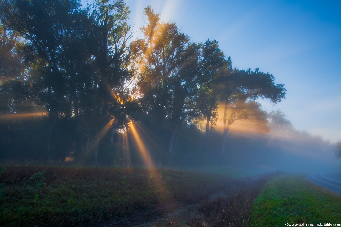
Rays of light beam through the trees at Desoto Bend NWR on a cool morning, September 4, 2010.
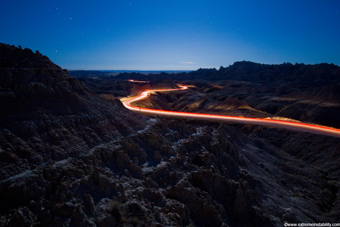
Bright moonlight illuminates the Badlands of South Dakota as car travels its twisty highway.
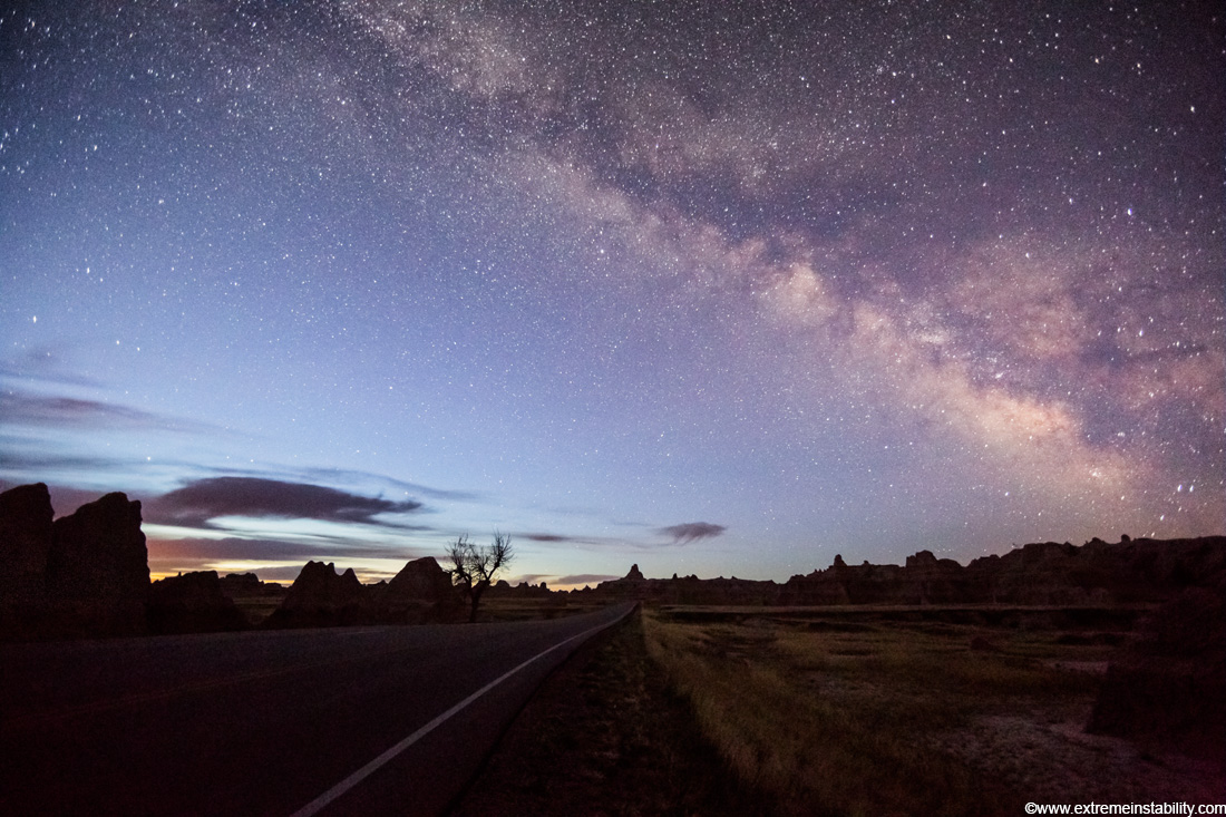
Milky Way shines over the Badlands of South Dakota during early morning twilight.
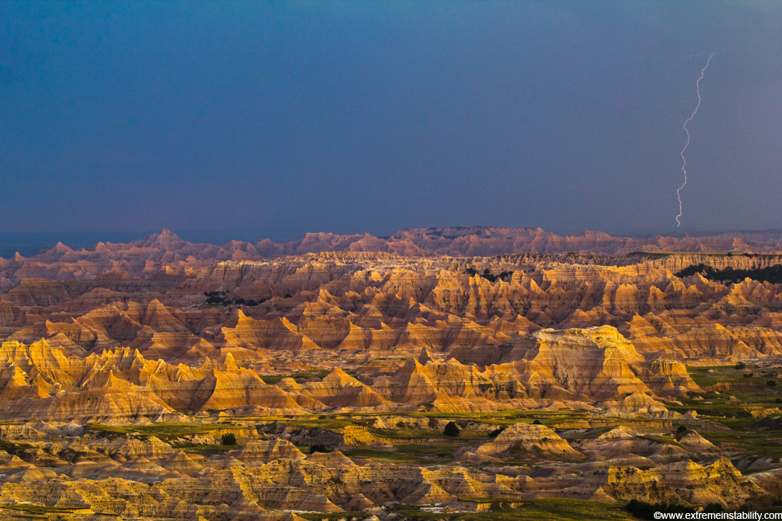
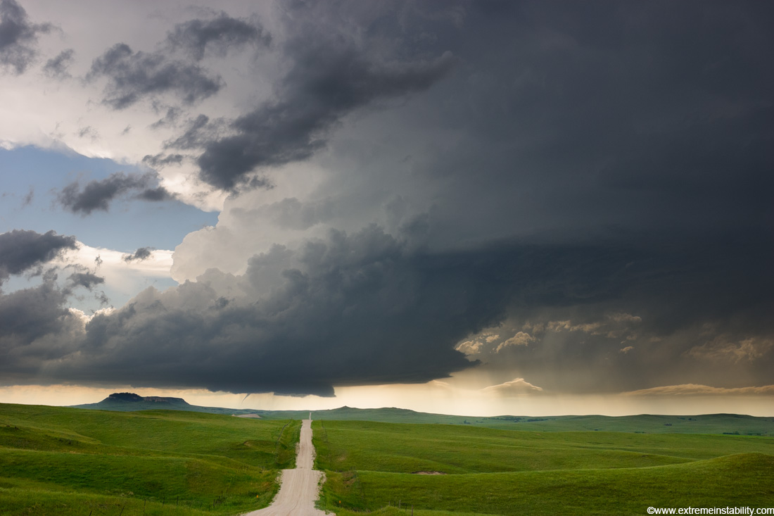
Beautiful terrain with a lightning strike in the background. Must see in bigger version (click to see).
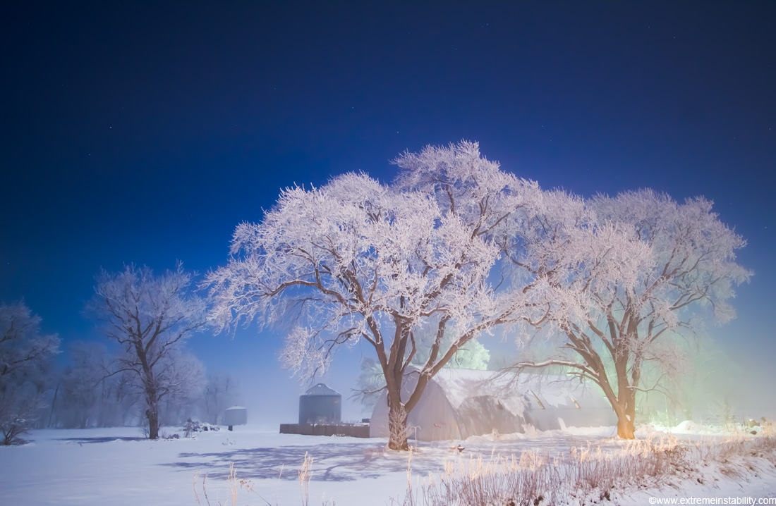
Moon lights frost covered trees in western IA during bitter cold freezing fog in sub-zero F temps.

Severe storm races southeast in southwest Nebraska June 10, 2006 producing high winds and small hail.
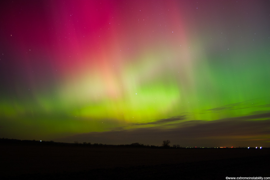
Extreme class geomagnetic storm produces bright auroras far south over eastern Nebraska November 7-8, 2004.
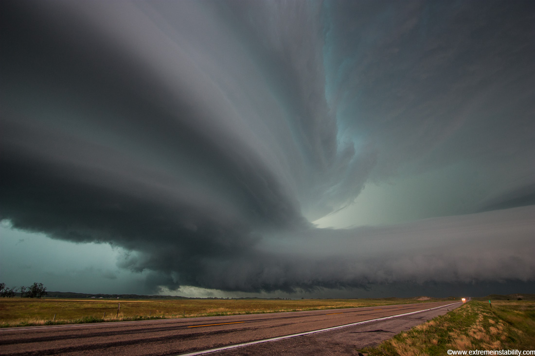
An amazing supercell tracks across southern Nebraska, producing other-worldy storm structures. At times this storm looked like a giant tsunami in the sky. The supercell formed after two supercells merged near McCook Nebraska. It then tracked eastward as one storm till it died after midnight east of Hastings Nebraska.
Very intense high precipitation supercell storm moves south in the Nebraska Sand Hills south of Valentine, July 13, 2009. Very low, long and fat inflow cloud stretches east of the storm. Winds gusted upwards of 60+ mph into this storm. Tornado warning with the storm mentioned baseball size hail and winds in excess of 100 mph, a rare warning text indeed. As intense of a storm as it was, it only produced one short-lived small tornado. Traffic heading north up highway 83 would be driving right into the storm's forward flank downdraft, which contained large hail and intense rain.

Ice storm devistates Springdale and other areas of northwest Arkansas January 27-28, 2009. Many areas recieved over 1 inch ice accumulations on top of thick amounts of sleet.
Intense mammatus clouds form over northern Oklahoma.

Ice storm devistates Springdale and other areas of northwest Arkansas January 27-28, 2009. Many areas recieved over 1 inch ice accumulations on top of thick amounts of sleet.
Fog flows through the South Dakota Badlands June 18, 2008.
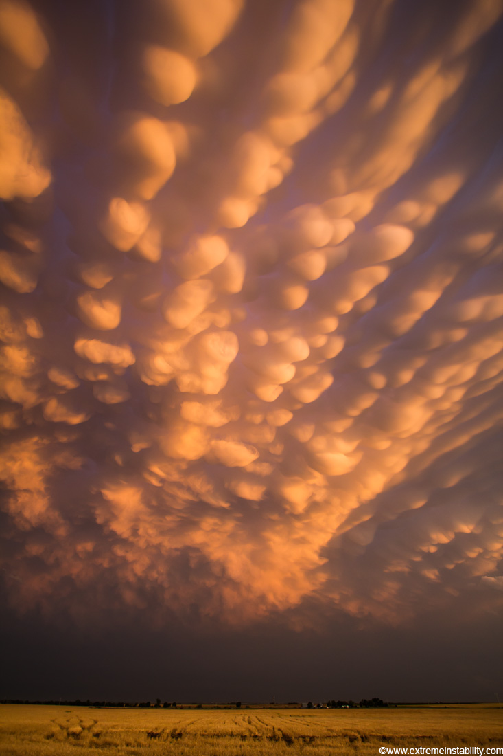
Mammatus fill the sky over flooded fileds in western Iowa during the historic 2011 Missouri River flood.
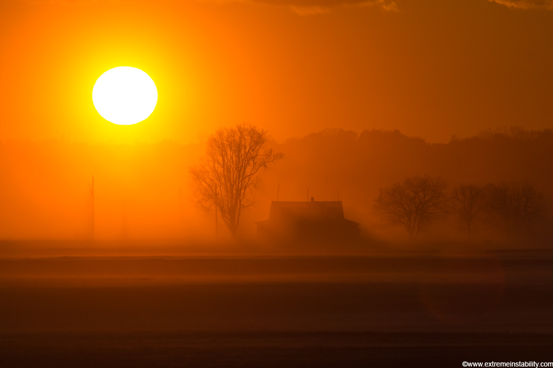
Sand blows across fields near Boyer Chute east of Ft Calhoun Nebraska. Desert-like conditions were left behind in areas along the Missouri River after the historic 2011 Missouri River Flood. The house is now abandoned after the flood.
Share this post:
Like our Facebook page & receive daily updates on your wall:

More by the Same Photographer
Surreal Storm Over a Highway
Aug 19 2011
Checkout this amazing storm captured in great, high quality photos. Make sure to click the images to view bigger versions. Location unknown.


